
Many hundreds of scientific experiments are performed aboard the International Space Station (ISS).
Some of these experiments help us to understand and take action against global climate change, a very real threat to life on Earth as we know it.
But how does space science help us to combat climate change?
It can be tricky to find these answers out, especially if you aren’t sitting on a few science degrees!
Well, no more. Today we have the answers for you, just keep reading to find out!
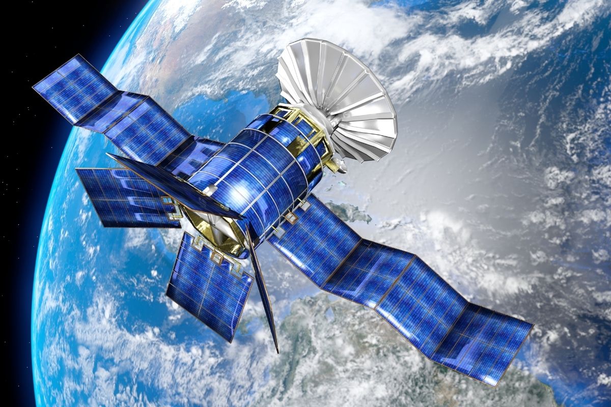
Satellite Data Collection
Guy Callendar was an amateur scientist who provided evidence that the earth was warming.
He was a little known scientist who didn’t get much recognition until he published his findings.
His work led to the establishment of the Intergovernmental Panel on Climate Change (IPCC).
Callendar was ignored because he didn’t fit into any established scientific theory.
He measured something nobody else had ever seen before. He found the greenhouse effect was real, but it was too late to do anything about it.
The world’s governments couldn’t agree on what to do in response to this new information so they decided to form the IPCC.
The IPCC has been monitoring the progress of climate change since 1988.
They have collected all available satellite data and used them to create models which predict future changes in temperature and precipitation patterns.
These predictions are then compared with actual measurements from weather stations around the world.
Scientists also measure global temperature by using satellites to detect infrared radiation from the earth.
The first satellite to do this accurately was NASA’s Nimbus-3, which was launched in the 1960s.
Today’s satellites are much more powerful and can detect smaller changes in temperature.
Knowledge Of The Earth’s Climate
There are many ways that space science helps us understand and mitigate against climate change.
We also know that carbon dioxide emissions are one of the main causes behind global warming.
Scientists are working together to create new instruments that will measure the amount of CO2 in the atmosphere.
These measurements will be used to determine how much carbon we’re emitting into the air.
This information will then be used to make decisions about how to reduce emissions.
Sea And Land Surface Temperature Measurements
Since the 1980s, scientists have been helping create highly accurate measurements of sea and land surface temperatures.
These include the ATSR series. The EU’s Sentinel satellites use these instruments to help monitor global warming.
2 satellites are orbiting Earth right now, and they provide global coverage every day.
These satellites collect data at different times of the year to allow for seasonal temperature variations.
In addition, they cover both land and ocean surfaces.
By combining these two types of data, scientists can see if there are differences between land and water temperatures.
These measurements are important because they show us when and where the most intense heat is being absorbed or released.
If we want to reduce the amount of carbon dioxide emissions, we need to be able to identify areas where the greatest amounts of CO2 are coming from.
Thunderstorm Studies

Thunderstorms form when hot air rises and hits cold air. Hot air rises because of convection currents, and cold air sinks because of gravity.
When the two meet, there is an electrical discharge that causes lightning strikes.
These electrical discharges create chemicals called ozone and nitrous oxide.
Ozone is a strong greenhouse gas, and nitrous oxide is a very powerful greenhouse gas.
Both of them contribute to climate change. Blue streamers corona is a type of electrical discharge that causes changes in the chemical composition of the atmosphere.
These changes can affect the weather patterns and climate in the future.
Coronas can be detected by satellites. Studying them will help us understand how climate affects storms.
ASIM is an instrument designed to observe and study thunderstorms.
By studying how these storms work, scientists hope to better predict the onset of extreme weather events such as hurricanes and floods.
Combating Forest Fires
Forest fires can have a knock-on effect on air quality around the world. Satellite data can be used to fight forest fires more directly.
Forest fires are becoming more frequent as a result of climate change. Satellite images show how many fires are happening around the world.
These satellite images help firefighters know when to send out firefighting planes and helicopters.
Enhancing Forest Health
Satellite data can be used to measure the forest’s health.
A healthy forest absorbs carbon dioxide from the air while sick trees emit more than healthy ones.
Trees that grow in hot climates are more likely to be healthy than those grown in cold climates.
Global Response To Climate Change
NASA is a world leader in studying climate change. Their job is to provide the data needed to understand climate change.
However, NASA doesn’t set any policies about how to deal with climate change.
This is because they do not have the authority to make decisions about the environment.
Instead, they focus on collecting data and making it available to other people who can decide what to do with it.
Our emissions of greenhouse gasses continue on a relentless increase.
In 2013, the average daily level of carbon dioxide reached 400 ppm for the first time in recorded history.
The last time this happened was 3-5 million years ago, during the Pliocene epoch.
We should all work towards reducing our carbon footprint. Climate change is already happening, so we need to adapt to it.
Luckily, modern technology such as those utilized in space science can help us figure out how to do that.
Mitigating And Adapting To Climate Change

Reducing greenhouse gasses is an important part of mitigating climate change.
We need to reduce emissions from fossil fuel combustion and other sources.
We also need to increase carbon sinks such as oceans, forests, and soils.
Adaptation is the process of adjusting to life in a changing environment.
People and societies have adapted to and coped with climate change throughout history.
Climate change has been at least partly to blame for the rise and fall and many civilizations.
Our climate has been relatively stable over the last 12,000 years and that stability helped us develop into what we are today.
We must adjust to a changing climate if we want to survive.
The faster the climate shifts, the harder it might be to cope with. Climate change is a global problem, but it is felt locally.
Cities and towns are therefore at the frontline. Flood defenses are built to protect them from flooding.
Heatwaves and higher temperatures are planned for.
Water permeable pavements are installed to help cope with floods and storms. More water storage and use are improved.
Governments around the world are adapting to climate change by planning for extreme weather events and sea-level rise.
They’re protecting coastal areas and developing new crops, managing land and forests, preparing for less water availability, and planning for reduced energy production.
How Is Climate Change Mitigated With Space Science?
With satellite technology, we can measure the carbon dioxide content in the atmosphere and use this information to study the effects of human activities on our environment.
We can predict earthquakes and tsunamis, detect volcanic eruptions and forest fires, forecast floods, and droughts, identify and locate oil spills, and understand how much water is available on earth and how much is being used.
We can control and regulate the amount of carbon dioxide in the air, prevent deforestation, and reduce pollution.
Information and communications technology (ICT) plays an important role in protecting the environment.
ICTs were used in the first space age of the 20th century. These technologies include GPS, which was widely adopted commercially.
This technology enables people to navigate anywhere in the world, and it also provides accurate information about weather and other environmental conditions.
However, ICTs have been implicated in many cases of environmental degradation, including deforestation, pollution, loss of biodiversity, and climate change.
Scientists say that satellites help us understand our planet better by measuring things we couldn’t before.
For instance, scientists use these satellites to measure the thickness of ice sheets and glaciers globally.
Scientists hope that information from next-generation satellites such as ICESAT2 – which takes measurements every 85 cm along its ground path – could improve forecasts for rising seas, as well as global temperature and climate patterns.
Farmers use satellite imagery to determine crop yields.
They use satellite imagery and climate data to help them manage water resources, monitor illegal mining activities, and achieve economic growth.
Final Thoughts
Climate change can be mitigated by using satellite technology to forecast extreme weather events and use them to protect people and animals.
Using space technologies, we can measure greenhouse gas emissions, monitor the weather, and predict natural disasters.
Using current technologies while advancing our knowledge of space science is crucial to helping us mitigate and adapt to global climate change.

- I Can’t See Anything Clearly Through My Telescope – Help! - April 26, 2022
- Astronomy For Beginners – Getting Started Stargazing! - April 26, 2022
- Are Telescopes Easy To Use? - April 26, 2022